Finale Ligure
Trail Area
Primary regional gravity infrastructure. Over 200 cataloged singletracks linking alpine ridgelines with the Mediterranean coast.
| Area Sector | Finale Ligure |
| Substrate / Terrain | Rocky / Soil (Pietra di Finale & Loam) |
| Vertical Extent | 0 – 1,200 m+ a.s.l. |
| Trail Character | Naturals Freeride / Enduro |
| Average Difficulty | STS S2 – S3 |
| Network Capacity | 200+ Active Tracks |
| Drainage Interval | < 2h on Limestone Slabs |
Mountain Biking in Finale Ligure
Finale Ligure represents the primary hub within the Finale Outdoor Region. The area is defined by its coastal topography and the proximity of the Ligurian Alps, resulting in an elevation range from sea level to approximately 1,200 meters. The trail network is composed of a complex system of historic mule tracks, former military routes, and purpose-built trails supporting technical enduro and all-mountain descents.
Area Infrastructure
The trail network constitutes the primary hub of the regional outdoor infrastructure. This sector is characterized by an extensive system of historic mule tracks, former military supply routes, and dedicated mountain bike trails. The area’s geography supports diverse riding styles, with trail connectivity providing seamless access across varied elevations from the coastline to inland ridges.
Geology & Terrain
The regional geology is predominantly defined by limestone formations. This composition results in specific surface characteristics, including exposed limestone rock slabs, loose-over-hard packed stone, embedded rock gardens, and root sections. Trail conditions fluctuate between shaded woodland sectors and exposed rocky hillsides, requiring riders to adapt to variable traction levels.
Trail Character
The network integrates high-speed flow sections with natural, technical enduro descents. The riding experience is defined by substantial vertical elevation changes, varied rhythm, and multiple line choices. Technical difficulty ranges from established flow paths to raw backcountry descents, leveraging existing natural topography to provide consistent technical challenges.
Finale Ligure Trail Database
| Trail Name | Sector | STS Rating | Length | Vertical Drop | Avg. Gradient | Substrate | Profile Character |
|---|---|---|---|---|---|---|---|
| Rollercoaster | Melogno / Din | STS S2 | 6.40 km | -620 m | -9.7% | Beech Loam / Roots | High-speed flow & compressions |
| Toboga di Canova | Melogno / Din | STS S2 | 4.40 km | -450 m | -10.2% | Hardpack / Forest Soil | Continuous natural berms & ditch |
| Kill Bill II | Melogno / Din | STS S2 | 3.10 km | -320 m | -10.3% | Loam / Minor Roots | Fast rhythmic flow sequence |
| Ingegnere | Base NATO | STS S3 | 6.40 km | -550 m | -8.6% | Forest Soil / Embedded Rock | Raw technical woodland descent |
| Crestino | Base NATO | STS S3 | 3.20 km | -380 m | -11.8% | Loam / Off-camber Roots | Natural technical freeride line |
| 115 (Base NATO) | Base NATO | STS S2 | 2.80 km | -310 m | -11.0% | Compact Soil / Roots | Fast classic ridge singletrack |
| Madre Natura | Base NATO | STS S3 | 3.10 km | -340 m | -10.9% | Loam / Rocky Steps | Technical woodland singletrack |
| DH Uomini (DH Men) | Le Manie | STS S3 | 2.40 km | -270 m | -11.2% | Pietra di Finale / Clay | Iconic sea-view rock slabs & drops |
| 24H Course (Briga link) | Le Manie | STS S1 | 4.80 km | -150 m | -3.1% | Red Clay / Compact Dirt | Rolling coastal singletrack loop |
| Cà Bianca | San Bernardino | STS S3 | 6.40 km | -410 m | -6.4% | White Limestone Bedrock | Technical rock gardens & hairpins |
| Dolmen | San Bernardino | STS S3 | 2.10 km | -290 m | -13.8% | Exposed Limestone Slabs | Historic EWS technical stage |
| Ruggetta | San Bernardino | STS S3 | 1.80 km | -250 m | -13.8% | Fixed Rock / Loose Stones | Steep rocky turns & compressions |
| I Volti | San Bernardino | STS S4 | 1.40 km | -220 m | -15.7% | Exposed Limestone Steps | High-gradient extreme rocky chute |
| Cacciatore | Feglino | STS S3 | 1.10 km | -210 m | -19.0% | Steep Loam / Clay / Rock | Steep technical chutes & switchbacks |
| San Rocco | Feglino | STS S3 | 2.20 km | -280 m | -12.7% | Dense Woodland / Rock Slabs | Traditional tight natural singletrack |
| Madonna della Guardia | Calice / Feglino | STS S4 | 0.81 km | -190 m | -23.4% | Sharp Limestone Bedrock | Severe rock slabs, zero run-out lines |
| Isallo Extasy | Calice Ligure | STS S3 | 6.40 km | -680 m | -10.6% | Mixed Loam / Granite & Slate | Long alpine backcountry descent |
| Revenant | Calice Ligure | STS S3 | 4.40 km | -430 m | -9.7% | Forest Loam / Natural Berms | High-rhythm sustained flow line |
Finale Ligure Riding Zones
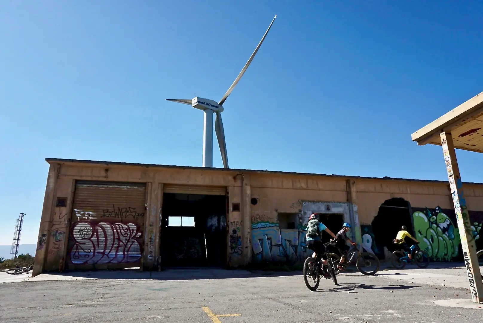 1,020 m+
NATO Base
| Terrain | Rocky / Soil |
| Trails | Naturals Freeride |
| Avg. STS | STS S2 – S3 |
 350 m+
Le Manie
| Terrain | Sandy Dirt / Loose Stones / Sharp Limestone |
| Trails | Panoramic Singletrack / Technical Sea-View Downhills |
| Avg. STS | STS S1 – S3 |
 1,200 m+
Melogno / Din
| Terrain | Deep Beech Forest Dirt / Roots / Fixed Limestone Slabs |
| Trails | High-Speed Flow Lines / Technical Alpine Enduro |
| Avg. STS | STS S2 – S3 |
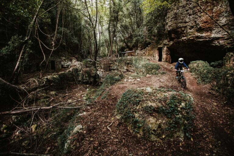 350 m+
San Bernardino
| Terrain | Sharp White Limestone / Solid Rock Slabs / Hard-Packed Red Dirt |
| Trails | Technical Rock Gardens / Historic Enduro Race Lines |
| Avg. STS | STS S2 – S4 |
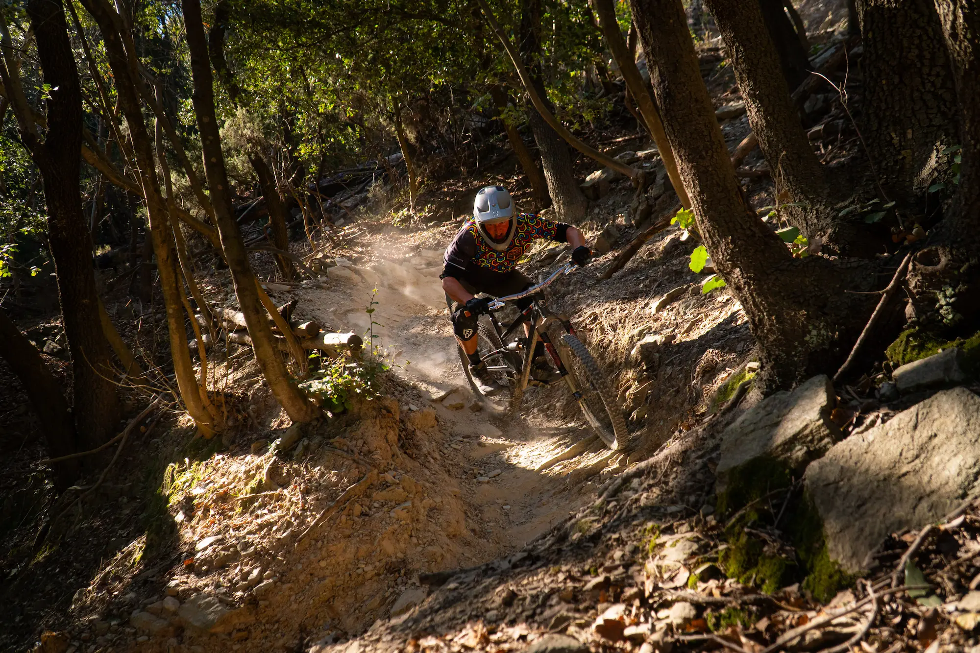 400 m+
Feglino
| Terrain | Steep Loam / Exposed Roots / Loose Rocky Chutes / Hard-Packed Clay |
| Trails | Steep Technical Singletracks / High-Consequence Gravity Lines |
| Avg. STS | STS S2 – S3 |
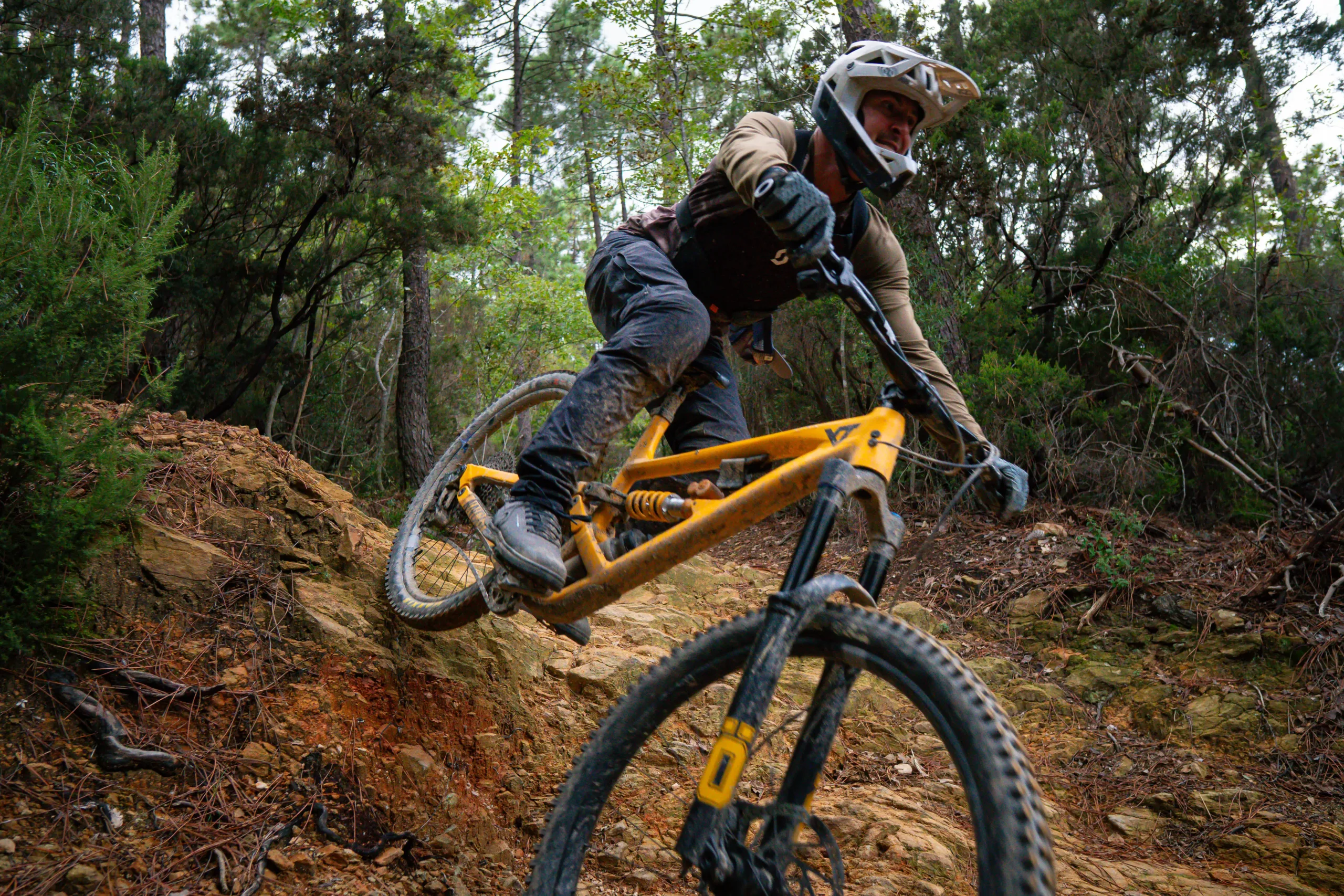 450 m+
Calice
| Terrain | Deep Forest Loam / Fixed Rocky Chutes / Hard-Packed Dirt / Smooth Berms |
| Trails | Iconic Flow Lines / Long Technical Enduro Descents |
| Avg. STS | STS S2 – S3 |
Best Time to Ride
Spring / Autumn
Optimal Window| Active Months | Mar – May / Sep – Nov |
| Ground Grip | High Stability / Low Dust |
| Target Area | Full Network Coverage |
These periods offer stable temperatures and consistent ground moisture, representing the optimal timeframe for trail usage.
Summer
Thermal Caution| Active Months | Jun – Aug |
| Recommended | > 800 m a.s.l. / Shaded Woods |
| Key Sectors | Melogno & Base NATO |
High temperatures are common in coastal zones. Usage is typically concentrated in higher-elevation zones or shaded forest areas to mitigate heat exposure.
Winter
Coastal Active| Active Months | Dec – Feb |
| Recommended | Sea-Facing Limestone Slopes |
| Key Sectors | Le Manie & San Bernardino |
Environmental conditions remain stable and conducive to riding. Precipitation levels are generally lower than in other alpine destinations, and trails remain accessible throughout the winter season.
How to Ride Finale Ligure
The trail network is accessed via a combination of public municipal roads, authorized fire tracks, and private shuttle routes. Independent access via pedaling is feasible, though the elevation gain and trail density often necessitate motorized transport for logistical efficiency. Trail maintenance and signposting are managed by local outdoor associations in collaboration with regional land management authorities.
LOG.01 Shuttle Service
Most of the best trails in Finale Ligure are accessed using shuttle services, allowing you to maximize descents and ride more technical terrain in a single day.
LOG.02 Guided Tours
For experienced riders, many areas can also be reached by pedaling, with long climbs leading to rewarding descents and more remote trails.
LOG.03 Private Experiences
Riding with a local MTB guide is the best way to discover hidden trails, avoid navigation issues, and make the most of your time on the bike.
LOG.04 MTB Holiday
Structured multi-day riding packages combining accommodation, uplift logistics, and guiding to experience the full extent of the Outdoor Region.
Featured Guided Tours & Shuttle Experiences
Structured itineraries designed to maximize descending mileage across specific geological formations. Each tour is led by certified guides with private uplift logistics.
Van Uplift Assisted
TR.01 The Classic Tour
| Primary Sectors | Melogno – Base NATO – Calice |
| Vertical Drop | -3,000 m to -4,500 m (4–6 runs) |
| Technical Grade | STS S2 – S3 • Advanced |
The benchmark Finale experience covering iconic ridgeline descents including Rollercoaster, Toboga di Canova, and NATO Base singletracks.
Van Uplift Assisted
TR.02 East Coast Sea View
| Primary Sectors | Le Manie – Spotorno – Noli |
| Vertical Drop | -2,800 m to -3,800 m (4–5 runs) |
| Technical Grade | STS S2 – S3 • Advanced |
High-exposure coastal lines over limestone bedrock, terminating on Mediterranean cliff-sides, including DH Uomini and historic seaside trails.
E-MTB / Pedaled Option
TR.03 Backcountry Wilderness
| Primary Sectors | Inland Valleys – Osiglia – Bormida |
| Elevation / Range | +1,400 m / -2,200 m • ~45 km |
| Technical Grade | STS S2 • Intermediate/Advanced |
Remote alpine-forest routing through deep beech loam and natural terrain away from high-traffic sectors, ideal for all-mountain and e-bike setups.
Custom Uplift / Private
TR.04 Technical Race Stages
| Primary Sectors | San Bernardino – Feglino – Guardia |
| Vertical Drop | -3,500 m to -5,000 m (5–7 runs) |
| Technical Grade | STS S3 – S4 • Expert |
High-gradient limestone descents and technical race stages including Cà Bianca, Dolmen, Ruggetta, and severe rock chute complexes.
Frequently Asked Questions
FAQ.01 Which Trail Area is best for first-time visitors?
There is no single “best” Trail Area for a first visit, as each part of the Finale Ligure Outdoor Region offers a different riding experience. Riders looking for flowing terrain and coastal scenery often enjoy Le Manie, while Melogno is known for its higher elevation, longer descents and classic enduro trails. Other areas feature more natural, technical terrain with rocky sections, ancient mule tracks and varied trail characteristics.
If it is your first time riding in Finale, choosing a Trail Area based on your riding ability, fitness and preferred terrain is more important than simply selecting the most famous location. A local guide can help match the most suitable area to current trail conditions, weather and your riding goals, allowing you to experience the region safely and make the most of your day on the trails.
FAQ.02 Which areas are suitable for intermediate riders?
Intermediate riders have plenty of options throughout the Finale Ligure Outdoor Region. Areas such as Le Manie are often recommended for riders progressing their technical skills thanks to their varied terrain, moderate elevation changes and a wide choice of flowing and natural singletracks. The plateau is also known for drying quickly after rainfall, making it a reliable option in changing conditions.
For riders with solid fitness and previous experience on natural trails, areas such as Melogno, Base NATO and parts of Monte Carmo offer a broader selection of intermediate routes mixed with more technical descents. The region features more than 200 MTB trails, allowing riders to gradually increase the technical difficulty while exploring different terrain and landscapes.
The best choice ultimately depends on your riding experience, confidence on rocky natural terrain and the current trail conditions. If you’re unsure where to start, a local guide can recommend the most suitable Trail Area and route for your ability level, ensuring a safe and enjoyable day on the trails.
FAQ.03 Which Trail Areas offer the longest descents?
The longest descents in the Finale Ligure Outdoor Region are typically found in the higher-elevation Trail Areas, where routes begin between 900 and 1,350 metres above sea level and descend all the way to the valleys or the coast.
Melogno and Base NATO are among the most popular areas for long enduro descents, offering multiple trail combinations with significant vertical drop and a wide variety of natural terrain. The Base NATO area is home to some of Finale’s longest and most iconic descents, while the nearby Melogno plateau provides access to an extensive network of classic enduro trails.
For riders looking for the ultimate descent, Monte Carmo stands out. Trails such as the legendary Karma Trail start at approximately 1,350 metres and deliver more than 1,000 metres of continuous vertical descent through alpine ridges, beech forests and classic Ligurian rocky terrain.
The best Trail Area depends on the type of riding you’re looking for. Some descents prioritise fast flow and speed, while others focus on natural technical terrain, rock gardens and challenging line choices. Exploring these areas with a local guide or shuttle service allows riders to combine several long descents into a single day while making the most of the region’s extensive trail network.
FAQ.04 When is the best time to ride in the Finale Ligure Outdoor Region?
Thanks to its mild Mediterranean climate, the Finale Ligure Outdoor Region is considered a year-round mountain biking destination. Riders can enjoy the trails in every season, although conditions vary depending on elevation, weather and trail exposure.
For most riders, spring (March to May) and autumn (September to November) offer the best overall riding conditions. Cooler temperatures, generally stable weather and excellent trail grip make these months ideal for exploring both coastal and high-elevation Trail Areas.
During summer, higher areas such as Melogno, Base NATO and Monte Carmo provide cooler temperatures and are often the preferred choice for full-day rides. Coastal areas remain rideable, but early morning starts are recommended during the hottest months.
In winter, many European mountain bike destinations are covered by snow, while Finale often remains rideable thanks to its coastal microclimate. Lower-elevation Trail Areas near the sea typically dry quickly after rain and continue to offer excellent riding opportunities throughout the season.
FAQ.05 Can I ride without a guide?
Yes. The trails in the Finale Ligure Outdoor Region are publicly accessible, and many riders explore the area independently using GPS navigation tools such as Trailforks or official trail maps. Shuttle services are also available without a guide for experienced riders who already know the trail network or are confident navigating on their own.
However, with more than 200 trails spread across multiple Trail Areas and Trail Zones, route planning can be challenging for first-time visitors. A local guide helps you choose the best trails for your riding ability, current trail conditions and weather, while also introducing lesser-known routes that are often missed by self-guided riders.
If you are visiting Finale for the first time, a guided ride is the best way to understand how the region is organised and experience a greater variety of trails in a single day. Once you are familiar with the area, riding independently becomes much easier and allows you to continue exploring with confidence.
FAQ.06 Do I need a shuttle service?
Not necessarily. Many trails in the Finale Ligure Outdoor Region can be reached by pedalling, making the area suitable for riders who enjoy earning their descents. However, because many of the region’s most iconic trails start between 800 and 1,300 metres above sea level, a shuttle service is the most efficient way to access higher elevations and maximise your riding time.
Shuttle services are especially popular with enduro riders, allowing multiple long descents in a single day while reducing long road or fire road climbs. Single uplifts and full-day private shuttles operate daily to major Trail Areas such as Base NATO, Melogno and Monte Carmo, giving riders quick access to the region’s most famous trail networks.
If your goal is to ride as many high-quality descents as possible, a shuttle is highly recommended. If you prefer a more traditional all-mountain experience, combining pedal climbs with natural singletrack descents is equally rewarding and remains one of the best ways to explore the Finale Ligure Outdoor Region.
FAQ.07 Are the trails signposted?
Yes, many trails and access routes in the Finale Ligure Outdoor Region are signposted, but the network is not designed as a traditional bike park. The region covers hundreds of kilometres of natural trails spread across multiple Trail Areas, with different access roads, forest tracks and historic paths connecting the trail network.
For this reason, most riders rely on GPS navigation alongside local signage. Platforms such as Trailforks are widely used to plan routes, locate trailheads and navigate between Trail Areas and Trail Zones.
If it is your first visit, we recommend downloading your route in advance or riding with a local guide. This makes navigation much easier and allows you to discover the best trail combinations while respecting the region’s extensive and continuously maintained trail network.
FAQ.08 Where can I rent a mountain bike?
Finale Ligure offers a wide range of mountain bike and e-MTB rental options, from premium enduro bikes to trail bikes and electric mountain bikes. Most rental centres are located close to Finalborgo and Finale Marina, making it easy to collect your bike before heading to the trails. Many shops also provide helmets, protection, accessories and setup assistance to ensure your bike is properly adjusted before your ride.
If you are joining one of our guided tours or shuttle experiences, you can also rent your bike directly through Finale MTB. We offer a selection of high-performance mountain bikes and e-bikes, allowing you to book both your riding experience and your rental in one place.
During spring, autumn and major riding events, demand can be very high. We strongly recommend booking your bike in advance to ensure availability and the correct frame size, especially if you are looking for a specific model or planning a multi-day riding holiday.
FAQ.09 Which Trail Areas are best during summer?
During the summer months, the best riding conditions are generally found in the higher-elevation Trail Areas, where cooler temperatures make full-day rides more comfortable. Melogno, Base NATO and Monte Carmo are among the most popular summer destinations thanks to their elevation, extensive forest cover and long natural descents.
Lower coastal areas such as Le Manie remain rideable throughout the summer, especially in the early morning or late afternoon, but they can become significantly warmer during the middle of the day due to their lower elevation and Mediterranean exposure.
If you are visiting Finale Ligure in July or August, we generally recommend planning rides in the higher Trail Areas whenever possible. Not only are temperatures more pleasant, but the combination of shaded forests, longer descents and varied terrain provides some of the best riding conditions of the year.
FAQ.10 How many days do I need to explore the Outdoor Region?
The Finale Ligure Outdoor Region is far too extensive to explore in a single day. With more than 200 mountain bike trails spread across multiple Trail Areas, each offering its own terrain, elevation and riding character, most riders need several days to experience the diversity of the region.
A 3-day trip is ideal for discovering the classic riding areas and some of Finale’s most iconic trails. If you want to explore a wider variety of terrain—including higher alpine areas, coastal singletracks and more remote backcountry zones—we recommend staying 5 to 7 days. This allows enough time to experience different Trail Areas without repeating the same routes and to adapt your plans to weather and trail conditions.
Many riders return to Finale year after year and still discover new trails. Thanks to the size of the trail network and the countless route combinations, every visit offers the opportunity to explore different landscapes, riding styles and hidden corners of the Outdoor Region.
FAQ.11 Are the trails suitable for e-MTBs?
Yes. The Finale Ligure Outdoor Region is one of Europe’s leading destinations for e-MTB riding, with an extensive network of natural trails suitable for electric mountain bikes. Many climbs are completed under your own power using the bike’s motor assistance, allowing riders to link multiple Trail Areas and enjoy longer rides with less physical effort.
E-MTBs are particularly well suited to exploring areas such as Melogno, Monte Carmo and the inland valleys, where longer climbs provide access to some of the region’s most rewarding descents. Depending on your fitness level and riding goals, you can combine pedal-assisted climbs with natural singletracks or use shuttle services to maximise descending time.
Although the motor makes climbing easier, the descents remain natural and technically demanding. Riders should still be comfortable on rocky terrain, loose surfaces and steep singletrack, as many of the trails were originally developed for enduro mountain biking. Choosing routes that match your technical ability is the best way to enjoy the full e-MTB experience in the Finale Ligure Outdoor Region.
FAQ.12 Is Finale Ligure suitable for beginners?
Yes, but it depends on what you mean by “beginner.” The Finale Ligure Outdoor Region is internationally known for natural enduro riding, and many of its most famous trails are designed for intermediate to advanced mountain bikers. Rocky terrain, loose surfaces and technical features are common throughout the region.
That said, Finale is not only for expert riders. Several Trail Areas include easier singletracks, forest roads and flowing trails that are well suited to riders with basic off-road experience who want to improve their skills. Choosing the right Trail Area and route is far more important than simply following the most popular trails.
If you are new to mountain biking, we recommend starting with a guided ride or a skills session. A local guide can select terrain that matches your ability, help you build confidence and introduce you to the region safely, allowing you to progress while enjoying one of Europe’s most iconic riding destinations.
FAQ.13 Which Trail Areas are closest to the coast?
The Trail Areas closest to the Mediterranean Sea are Le Manie, Caprazoppa and the coastal hills surrounding Finale Ligure. These areas can be reached quickly from Finale Marina and Finalborgo, making them an excellent choice for riders who want to maximise trail time with minimal transfers.
Coastal Trail Areas offer a unique riding experience, combining natural singletrack, Mediterranean vegetation and panoramic sea views. Compared with the higher inland mountains, they generally feature lower elevations, shorter access climbs and trails that dry quickly after rainfall thanks to the region’s mild coastal climate.
Because of their convenient location and year-round accessibility, the coastal Trail Areas are particularly popular for half-day rides, winter riding and riders looking to combine mountain biking with a seaside holiday. They also provide easy access to guided tours, shuttle meeting points and bike rental services based in Finale Ligure.
FAQ.14 Can I join a guided tour if I'm riding alone?
Absolutely. Solo riders are welcome to join our shared guided tours, which are designed for individuals and small groups who want to ride together. It’s a great way to experience the Finale Ligure Outdoor Region, meet other mountain bikers and discover the best trails with the support of a local guide.
If you prefer a more personalised experience, you can also book a private guiding service. This option allows the day to be tailored to your riding ability, fitness level and preferred style of terrain, giving you complete flexibility to explore the Trail Areas that best match your goals.
Whether you choose a shared or private experience, joining a guided tour is one of the best ways to discover the region. Local knowledge helps you link the best trails, avoid unnecessary transfers and make the most of your time on one of Europe’s largest natural mountain bike networks.
Area: Finale Ligure
Max. Altitude: 1,200 m+
Terrain: Rocky / Soil
Trails: Naturals Freeride
Average difficulty: S2 – S3